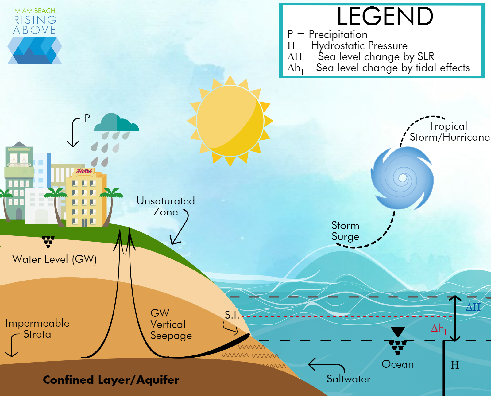
Groundwater is the water occurring in the underground beneath the surface of Earth. It runs through geologic formations in cracks and spaces in soil, sand, and rock called aquifers. An aquifer is the geologic formation where groundwater flows and yields usable quantities of water.

The City is in the process of implementing a comprehensive groundwater monitoring program through the installation of monitoring wells in north to south and east to west configurations across the barrier island. This continuous investigation will allow for a better understanding of groundwater levels, direction, velocity, salinity, and the local geology as well. With this information, the understanding of flooding and sea level rise effects within the City will be greatly enhanced.
Groundwater seepage is directly influenced by the highly permeable limestone and sandy formations beneath the city. In addition, tidal effects tend to elevate groundwater table levels while sea level rise only exacerbates this problem by exerting more upward pressure from both the ocean and canal sides. Furthermore, higher groundwater tables reduce the capacity for soils to store surface water through infiltration. This surface water can, for example, come from precipitation or even storm surges resulting from tropical storm events or hurricanes.
Groundwater data will be recorded continuously, considering that at least nine months of consistent data collection are needed to stabilize the dataset. The goal is to develop numerical models and run climate change and atmospheric scenarios to assess gray and green engineering solutions. The purpose is to provide robust technical base for planning and decision making processes. Types of assessments will include sea level rise, saltwater intrusion, dewatering, and stormwater contamination, among others.

